
Time on My Hands
Chapter 38: 334-343 CE: The Zoo
They plans were adjusted so the 80 ships could sail in 10 ship fleets of colonists and supplies to leave at 1 week intervals. That would ease loading and unloading jams at both ends of the voyage. Each 10 ship fleet could do 2 voyages a year. Leaving Zarbam in mid-April the first 10 ship fleet would load and unload in 6 days conducting a 7 week resupply voyage. One of the July voyages would include the 5 yearly Bazram ships. The spring fleets would take 2100 colonists, 50 each from Mazbar and Zamrab with the rest from Barmaz. The July fleet would take 2050 colonists, 50 from Bazram and the rest from Barmaz.
Raben consolidated all marine aspects of Corvus Shipping in Zarbam. The harbor, running northeast from Berre-lEtang northeast was completed with 100 docking slips and 200 anchorages. A second harbor of equal size began at the village of Les Branches running southeast for 2 miles. The new warehouse area would be shared with the original warehouses. The harbor master was kept busy with the coming and going vessels. A logistics manager would handle the local arrangements to obtain the goods Ramzab needed. Letters between colonists and family left behind could be exchanged. The sailing time back and forth between Ramzab {Madeira} and Zamrab averaged 7 weeks. The palisade walls were in place. Living quarters were built as were warehouses and commercial. The permanent population of the busy port reached the target of 4000 people not including the Raven Raiders.
With the colony on Ramzab thriving, Raben now had time to return to his business enterprises. The Corvus Scriptoriums were booming. Alexandria was a seething roiling mess of competing Christian ideas and beliefs that often came to blows. At the same time in the deserts foothills west of Alexandria the Christian ascetics began forming Monasteries. These were men awaiting the return of Christ who felt Roman society was too debauched, the constant temptations too great to resist. In the solitude and deprivation of the desert they could, with undistracted praying, gain a purer soul and discover the deeper meanings of a good and clean life. The legalization of Christianity created a weird sort of nostalgia for the tradition of martyrdom where one would be purified by sacrificing your life for your faith. Without persecution one could not become a martyr in the traditional sense. An alternative was a withdrawal from corrupt living in towns and cities. The ascetics sold all material possessions and donated it to the poor. Many felt poisoned by the Church finding ways to work with the Roman state, seeing it as a compromise between ‘the things of God and the things of Caesar.’ The monastic communities were essentially an alternate Christian society since the hermits doubted that religion and politics could ever produce a truly Christian society. To them the only true Christian society was spiritual.
Raben did his best to live his Christian faith. He lived in and was part of the world and believed withdrawing was counterproductive. Since Jesus lived in the world and was part of the world, by avoiding life and temptation they were denying Christ. He believed one could live a good life and follow Christ’s teaching in the world. However, one also had to protect the weak and provide for the poor. Doing so for everyone was impossible. Even Jesus had said the poor would always be with you. The best you could do was to provide hope and security for as many as possible. The ascetics did nothing to help those in need, being too busy protecting their personal sanctity.
In 334, disgruntled Sarmatian commoners overthrew their leaders. Constantine led a campaign against the tribe winning a victory and extended his control over the region. Constantine resettled some Sarmatian exiles as farmers in Illyrian and Roman districts, and conscripted the rest into the army. In Rome, things were still changing. With Constantine moving the seat of government to Constantinople the bureaucracy moved too. The senate had lost all power outside the city and environs. Many senators relocated east to join the emperor. This created a power vacuum that was quickly snatched up and assumed by the Church and the Bishop of Rome. The power plays and games that had roiled the senate moved over to the ecclesiastical realms. On December 31, 335 the Bishop of Rome, Sylvester, died. By January 18, 336 Mark was elected Bishop of Rome. None of the bishops outside of the vicinity of Rome made the hasty convocation. Politics was most definitely at play.
For Raben that only reinforced his commitment to seeing that the Clan Corvo was safe. In Barmaz he did a lot of research in the archives to find ways of beefing security and self defense. By combining many inferences he came up with several ideas that required experimentation. Those at the Clan Corvo University did the experimentation. Turpentine was derived from the sap of pine trees. Sulfur was easily procured from volcanoes. Mixing powdered sulfur with turpentine produced a highly flammable liquid that was difficult to extinguish and produced choking toxic fumes.
Placing the solution in small ceramic balls sealed with oil soaked rags made ideal flaming bombs. The tail of the rag was ignited then the ball thrown. Upon striking an object, the ball would break and the flaming rag ignite the solution. These could be made in different sized balls, from four inch hand thrown bombs to twenty inch catapult launched bombs. In addition, special hollowed ballista bolts could be filled with the mixture and flaming rags attached, then shot at great distances with the shaft shattering upon impact. Catapults and ballistas were added to all Clan Corvo armories as well as turpentine/sulfur bombs. The ingredients and materials to make the bombs and bolts were kept separate but close so in times of need they could be assembled. The militia practiced with live bombs. Several people were assigned to conduct further research on improving the devices.
Raben had been searching for a place to set up an office of Corvus Scriptorium near Constantinople. His requirements were proximity with isolation, with easy ship access. In mid 335 he found Sivri Ada, a rectangular island 500 feet wide by 1000 feet long and 35 meters high located 9 miles south of Constantinople in the Sea of Marmara. The uninhabited island had no fresh water and limited vegetation. Channels could be cut around the high center mount of the rocky to funnel rain into a cistern. The eastern side had a small protected natural harbor. Corvus Scriptorium dispatched over 50 scribes and managers to establish the eastern office in a rented building until the island could be prepared. Several people from Corvus Construction headed east to oversee local contractors in building the cistern, apartments, warehouses and the scriptorium on the island. This location of Corvus Scriptorium would be known as Marzab. The construction took a year. By the time the island was occupied, the new local office of Corvus Scriptorium had established itself as fulfilling the legacy and respect due the world’s premiere scriptorium.
By 336 it became evident Ramzab {PD Maderia} needed a continuing steady supply of cement. They were using a tremendous amount in the Clan Corvo homeland to build roads, bridges, dams, irrigation projects, and defensive walls. Ramzab needed a steady supply of cement so the colony could proceed with the construction of dams and terrace walls. Currently they were purchasing the cement for all their needs. The cement was packaged and transported in heavy wooden barrels containing 4 cubic feet of cement powder with each sealed cask weighing 375 ponds. Raben decided it was time the Clan Corvo began producing their own cement. There was certainly enough limestone in the Clan Corvo territory. Limestone quarries were needed as well as a heat source for burning the limestone, a requisite step in processing the limestone into the lime powder that was cement. Using wood for the fires would certainly deplete the tree reserves.
There were no coal deposits in the original province of Alpes Graiae Et Poeninae. As soon as Raben secured the Allobroge addition, he dispatched student engineers to various Roman mines to learn all they could about minerals and discovering mineral deposits. Then he sent them out into the Allobroge territory looking for evidence of exploitable mineral deposits. They found coal, silver/lead, iron and even traces of gold flecked quartz. Raben checked their discoveries and set up another new business, Corvus Minerals to begin exploiting the discoveries.
Coal mines and limestone quarries were the priority. Iron mines were secondary priorities. The silver/lead and gold mines were tertiary. All three were promptly started but the resources devoted were done by their set priority.
The yearly delivery of colonists and supplies kept the fleet busy all spring and summer to keep the colony well supplied. With the steady influx of people they became more and more self sufficient and were quite grateful to the rest of the Clan Corvo for funding their expenses. The colony’s only export was the dried fish they loaded onto the supply ship fleets. The profit was never enough to pay for their needs but it was the only export they had. Someday they hoped to have grain and other foodstuffs to sell.
Raben was ready to begin another massive defense project with the intent to protect the expanded province of Alpes Graiae Et Poeninae. The defense walls along the Rhone and Lac Leman were progressing. All entre points into the province had also been shut off by forts. The borders had been surveyed and mapped and plans were moving forward to wall the entire province with defensive walls and long steep glacis like those around the Barmaz Bailiwick. Better than 95% of the population was Clan Corvo. The few people who were not members of the clan were heading towards marrying into the tight knit clan.
As Raben made his precautionary plans, the stability of Constantine’s rule was about to end. Just after Easter, Constantine fell seriously ill. He left Constantinople for the hot baths near the city of Helenopolis {PD Altinova}. Realizing he was dying he prayed in a church his mother built. Seeking purification, he became a catechumen, and attempted to return to Constantinople, making it only about 15 miles. Unable to continue he summoned the bishops. The emperor had hoped to be baptized in the Jordan River but knew that would never happen so he requested immediate baptism, promising to live a more Christian life should he live through his illness. Constantine died soon after on the last day of the fifty-day festival of Pentecost, 22 May 337, quite literally being baptized on his deathbed.
Although Constantine legalized and supported Christianity, he delayed being baptized until his end. Many thought he did so to avoid violating the tenants of the faith. Since baptism washed away one’s sins, by holding off as long as possible he was hedging his bets.
Constantine’s three sons, Constantius II, Constantine II and Constans, succeeded him. Constantius II buried his father then set about killing the male relatives of his grandfather except his brothers and three cousins. The trouble quickly began. Constantine had been keeping the various Christian factions peaceful. With his steadying hand gone, so was the peace.
Raben stayed out of the way in Alpes Graiae Et Poeninae. The Clan Corvo politically and religiously controlled and effectively populated the province. Since the Clan Corvo took over the provincial governorship twenty five years before, the changes in governance had been many. Those who had fled with the previous governor when Constantine passed through had not been allowed to return. Qualified people from the Clan Corvo filled all vacant positions. Raben had made it clear all job holders, including those from the Clan Crovo, would maintain their positions by merit only. The other change was one virtually unheard of in ancient (and sadly in much of modern) times, the elimination of the taking and giving bribes. The punishment for either was enslavement and confiscation of all possessions. Signs were posted at all government offices and military checkpoints proclaiming the edict. Unfortunately many business men ignored the notices and suffered an ignominious fate. Many businesses didn’t like that nor the fairly applied taxes and levies. Unable to break through the Clan hierarchy, many tried to abandoned the trade routes that passed through the province. However, the main Roman road, Via Domisia, from Italy to Gaul and Hispania passed through the Allobroge area. The Col de Montgenèvre {GM 44.940608, 6.754154} from Turin had to be used as there were no other overland routes that were open year round. Only smaller honest entrepreneurs used the other roads, finding the way well maintained and safe. One of the provincial militia’s primary duties was seek out, pursue and eliminate brigands and thieves.
Construction of defensive walls and glacis around the new boundaries of the expanded Clan Corvo was begun in earnest home. A 75° glacis was cut/excavated/built in front of each wall. Along streams/rivers the glacis was 30 feet high. All other glacis were made with a minimum of 30 feet but as close to 300 feet high as the terrain permitted. Covered arcades along the top of the walls under the battlements allowed easy year round movement without need to worry about the weather.
The boundary was adjusted to follow ridge lines and/or watershed divides and glaciers. Where streams passed through the walls the stream beds were widened and deepened. Cut stone blocks were laid to a depth of 6 feet were placed to form the streambed extending 20 feet beyond the 30 feet high glacis to guide the discharge to prevent undermining the stonework. The 75° built stone glacis was perforated by channels 8 inches wide by 2 feet high spaced 6 feet apart. Up to 2 additional channel layers could be added to accommodate the spring snow melt flow, with each level offset 2 feet to keep the glacis and wall as strong as possible. The stone construction of the glacis extended back forming the solid underpinning of the defense wall which was built atop it.
{I can be quite anal about details. Rather than bog down the story I’ve attached detailed description of the borders and defenses in the comments of this chapter.}
Once Raben had the massive defensive project started, he moved on to other projects and maintaining his enterprises. After making a trip to Mazbar, Marzab and Zamrab, he arrived back in Zarbam in time to return to Ramzab {PD Madeira} on the spring resupply return voyage. The colony was doing well with over 18,000 people with 4150 new colonists arriving each year. The farms were doing well, fruit trees flourishing, the herds and flocks large enough to provide dairy and meat.
The only issue facing the colony was the lack of salt. So far they had been doing small scale evaporation of seawater but Ramzab was too hilly for suitable evaporation ponds. Raben knew Later Island {PD Island of Porto Santo} was fairly flat in the southwest corner. To insure a steady supply of salt Raben procured a dozen Archimedes screws and the mechanical gears and bearings for the associated windmills for use on the salt ponds. Wind mills would also be effective for milling their grain.
While they had initially arrived they sailed around the island and no one had landed. Raben sent several Ravens to scout the island, thanking the birds when they reported their findings. Raben then spoke with the fishing crews. They verified there were large flat areas near the ocean on the southeast side of Later Island. As they organized an exploratory trip Raben dispatched a dozen ravens to do a closer fly over examination of the island.
Raben led an evaluation expedition to Later Island. There was a small cove on the southern tip where they beached the ships. The shore party found the area suitable to construct evaporation ponds. They would need to dig and waterproof the settling and evaporation ponds, then flood them in late May, allowing the water to evaporate over the dry summer so they could harvest the salt in late August. Depending on the rain and evaporation they could probably get two to three batches during the three month dry season. Salt-making operations were to be conducted in a series of three ponds. The ponds were separated from each other by 3 feet high by 8 feet wide well constructed dikes. The tops of the dikes would serve as roadways over which wagons and horses could travel. A slough would need to be dug a few feet deeper than low tide to allow the ocean water to flow inland. At the end of the channel the Archimedes screws propelled by wind mills would raise raw seawater into the highest ponds were it would sit for five days allowing suspended solids to settle out. That water would then be drained into a lower pond to allow evaporation to concentrate it into brine. When the solution became concentrated to the point the salt was ready to start settling out, the brine would then be drained into a lower crystalizing pond where the water would be evaporated off. They would start off with one set of ponds adding more as the need arose.
Raben realized they’d need to have a crew living on the island during the dry season to tend the ponds. To do so they also had to construct dams and cisterns on the arroyos to catch and hold fresh water. Looking at the dry southern relatively flat shore of the island they realized they could also set up a larger designated area for drying and storing fish for export. Another use of the dry island would be for olive cultivation. The dryer island seemed like the perfect environment for large drought resistant olive orchards. A small village would be needed which meant limited food and grain crops and probably sheep. Later island was coming into the present. Raben estimated Later Island could support a population of 5500 people compared to 289,500 for Ramzab.
One thing Raben wanted started was a shipyard. The people from Bazram had shipbuilding experience so the area designated for a shipyard was prepared to expand from storage, maintenance and repair to actual construction.
Growing flax in the colony was doing well. A larger press for extracting linseed oil from the seeds was needed. Also needed were larger looms to process the flax straw into linen cloth. Another flourishing import was hemp. This would be the basis of a soon to be profitable rope making industry. Quality wine was being made from the vineyards planted at higher altitudes. Raben left with the summer resupply voyage with a never ending ‘to do' list.
Upon Raben’s return to Zarbam he placed orders for goods and supplies as well as mechanisms for the additional windmills to ship out on the summer supply voyage. Raben then accompanied Corvus Shipping caravan to Barmaz where he discovered a growing dispute within the Church.
The Bishop of Rome and the vast majority of the bishops and priests under his jurisdiction held the theological view of Catholic Christianity believing in the Nicene Creed description that Jesus is God the Son being a single essence with God the Father along with God the Spirit. The Trinity is one of the cornerstones of Catholic Christianity. Many in the east, centered in Constantinople, believed in Arianism, a monotheistic Christological doctrine which asserts the belief that Jesus Christ is the Son of God who was begotten by God the Father at a point in time, is distinct from the Father and is therefore subordinate to the Father based on the belief that the Son of God did not always exist. There was an often acrimonious dispute between the two interpretations (Arianism and Catholicism) based upon the theological orthodoxy in power. Both attempted to solve their theological dilemma by condemning the other as blasphemy. So there were two ‘orthodox’ competing interpretations of Christianity which initiated conflict in order to attract believers and define the supreme orthodoxy. Catholicism was formally affirmed by the Ecumenical First Council of Nicaea of 325 which deemed Arianism to be a heresy. The great majority of Christians had no clear views about the nature of the Trinity and they did not understand what the two sides were arguing about. At the regional First Synod of Tyre in 335, Arianism was exonerated. Constantine had been baptized by an Arian bishop. His son Constantius II was Arian while sons Constantine II and Constans were Catholic.
The drama grew as Constantine II grew jealous that younger brother Constans had more territory. While Constans was involved in fighting across the Danube in Dacia, Constantine II attacked. Constans sent troops who killed Constantine II in an ambush on December 24, 340. The Franks took advantage of the imperial chaos to invade Gaul which Constans drove back during 341 and 342. While the oldest and youngest brothers were engaged, Constantius II was busy fighting off the once again invading Persians.
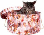
In December 342 Fiach landed in Alexandria heading for Zamrab. The docks were in chaos due to a dealer in exotic animals trying to find a ship sailing to Constantinople where he hoped to sell his stock. Unfortunately he couldn’t find anyone to take the entire shipment in one load and didn’t trust anyone he was not with to see the animals safely through the voyage. The city wanted the animals gone, either shipped out or simply moved to the countryside. The dealer was furious because of the cost of feeding the animals, especially the ravenous tigers. It was getting bad as the big cats were being underfed and anyone getting close to their cages was putting their lives in danger, which was the main reason no merchants wanted to risk their ships. Curious, Fiach headed to the impatient frustrated exotic animal dealer. What she found disgusted her. None of the animals were being treated well or fed properly. Most were on the verge of starvation sickness.
Fiach could see the dealer was in over his head so offered to buy the entire collection. The dealer dismissively demanded 2000 gold pieces.
“You’re never going to get that much,” Fiach bluntly told him. “I’ll give you 1000 silver.”
“What?” the frazzled man screamed. “That’s insulting! I have more than that invested!”
“That may be but the animals will soon be getting sick and die, then you’ll have nothing,” Fiach declared. “My offer will at least get you some return and relieve your headaches.”
“That’s robbery,” the irate man screamed.
At that point the harbor master and his security forces arrived. “Enough,” the beleaguered bureaucrat scolded. “I gave you two days to get these animals off the docks. It’s been three days. Either move them or we’ll be forced to kill them.”
The dealer’s mouth flopped open and snapped shut several times as he struggled to speak. His face turned bright red. Suddenly he incoherently screamed, pulled a knife and attacked the harbor master.
The harbor security was caught unprepared and the crazed man’s knife was raised ready to plunge into the harbor master’s chest. The harbor master froze in fear as he watched with horror as the knife was about to plunge into him. Suddenly the crazed dealer staggered and gasped dropping the knife. Slowly he pivoted in time to see a knife flying toward him sinking into his heart. With a final gasp he fell forward, dead before he hit the ground.
Everyone watched in awe as Fiach calmly stepped forward and pulled her knife from the dead man’s chest wiping it clean on the dead man’s robes before rolling him over to retrieve the first knife she’d thrown from between the man’s shoulder blades which she also wiped clean.
“Dumb ass,” Fiach said as she shook her head. “You should have taken my offer.”
Comments
Barmaz borders as promised in the story
Rising from the gate complex to the south and east above the Lac Leman village of Veytaux {GM 45.497415, 5.713619} began the defensive walls and glacis, like those of the Barmaz Bailiwick. The construction climbed northeast up the mountain from the lake gate house complex to the peak Les Dentaux {1714m} then up to the peak Rochers de Naye {2042m}. The boundary followed the north ridge down picking up the present day border of the Swiss Cantons Vaud/Fribourg with adjustments and deviations to maintain watersheds. The streams Hangrin {GM 46.447797, 7.017587} and Sarne/Saane {GM 46.474857, 7.039672} flowed through the defenses as noted. At the Dent de Ruth {GM 46.553684, 7.237158 - 2236m} Vaud/Fribourg meets Vaud/Bern, the boundary follows that border to the peak Eggterm {GM 46.582078, 7.278449 - 1934m} The Boundary continues northeast along the ridge through the peak Gastlosen {GM 46.590109, 7.284539 - 1935m} then down the ridge and across the valley of the Jugne, which flows through the defenses and blocks the alpine pass, then up to the peak of Baderhorn {GM 46.613182, 7.327425 - 2009m}, then heads southeast into the valley of the Simme which flows through the defenses at GM 46.596116, 7.375516 with a gate complex, then east up to the peak Hornguger {GM 46.600429, 7.410102 - 1824m}, then south along the zig-zagging ridges {to GM 46.586922, 7.419169} southeast across the watershed divide to the peak Geisshörnli {GM 46.576708, 7.438602 - 2031m}, to peak Muntiggalm {GM 46.573341, 7.440967 - 2077m}, then south across the watershed divide to peak Fromattgrat {GM 46.557875, 7.444541 - 2177m}, then south along the ridges to peaks Spillgerten {GM 46.536555, 7.446557 - 2307m}, Rothore {GM 46.535560, 7.452557 - 2410m}, Bluttlighore {GM 46.536204, 7.464607 - 2323m}, Raufligrat {GM 46.528734, 7.491852 - 2259m}, Türmlihore {GM 46.517386, 7.514205 - 2490m}, Landvogtehore {GM 46.514600, 7.524721 - 2615m}, Gsür {GM 46.372643, 7.392459 - 2709m}, Hempliger {GM 46.497990, 7.499792 - 2483m}, Sattligrat {GM 46.488787, 7.491454 - 2539m}, Laveygrat {GM 46.467783, 7.494539 - 2248m}, Rägeboldshore {GM 46.442033, 7.504462 - 2193m}, Ammertespitz {GM 46.433362, 7.524825 - 2613m}, Grossstrubel {GM 46.412640, 7.562202 - 3243m}, linking to and following east the Bern/Valais border through and closing the Grimselpass {GM 46.561371, 8.336817 - 2164m} to where it merges into the Uri/Valais border {GM 46.652947, 8.410179}. The boundary follows the Uri/Valais border through and closing the Furkapass {GM 46.572598, 8.415080 - 2429m} until it merges into the Valais/Ticino border {GM 46.527568, 8.477789} following that border through and closing the Nufenen Pass {GM 46.477130, 8.387535 - 2478m}to Piccolo Corno Gries {GM 46.452258, 8.384574 - 2928m} merging into the Valais/Swiss/Italian border westward to GM 46.249577, 8.102022 leaving the border southwest to peaks Hübschhorn {GM 46.237825, 8.057127 - 3192m}, through the Simplon Pass with a gate complex {GM 46.249124, 8.029900 - 2006m}, and the peaks Tochuhorn {GM 46.256265, 8.000968 - 2648m}, Straffelgrat {GM 46.248868, 7.984494 - 2633m}, Magehorn {GM 46.233420, 7.980596 - 2621m}, Galehorn {GM 46.222660, 7.983323 - 2797m}, Böshorn {GM 46.198939, 7.992739 - 3268m}, Senggchuppa {GM 46.179190, 7.995244 - 3606m}, Fletschhorn {GM 46.167828, 8.003074 - 3993m], Lagginhorn {GM 46.157255, 8.003001 - 4010m}, Weissmies {GM 46.127696, 8.012015 - 4023m}, Portjenhorn {GM 46.110759, 8.024241 - 3567m}, Portjengrat {GM 46.106201, 8.028310 - 3584m}, Pizzo d'Andolla {GM 46.100802, 8.034765 - 3654m} picking up the Valais/Swiss/Italian border through the Poeninus Mons {GM 45.869225, 7.165445 - 2469m} with a Gate Complex then on to Mont Dolent {GM 45.922660, 7.044057 - 3820m} merging into the Valais/Swiss/French border. From there the boundary follows the Haute Savoie/French/Italian border to the Savoie/French/Italian border {GM45.778423, 6.802298} following that through and closing the Col du Petit Saint-Bernard {GM 45.680148, 6.884053 - 2188m} to the pass Col du Mont Cenis {GM 45.259942, 6.901664 - 2083m}. The pass is above the border/boundary so the stream flowing into Italy and gate complex were built on the border {GM 45.259942, 6.901664}. The boundary continues following the Savoie/French/Italian border dipping down to the village of Pian del Colle where it closes the pass of Colle de l’Echelle {GM 45.050104, 6.669555 - 1762m} on to the Col de Montgenèvre {GM 44.940608, 6.754154 1854 m} with a gate complex through which the Via Domizia, the Roman road that connected Italy to Hispania through the south of Gaul. Continuing along the French/Italian Border through and closing the pass Col de Agnel to the pass Col de Larche {historically Col de l'Argentière GM 44.421724, 6.898204 1996 m} with a gate complex, continuing along the border to where the border of the French Provinces of Alpes de Haute/Alpes Maritime {GM 44.361046, 6.887428}, then following that boundary to {GM 44.118289, 6.719081}. At that point the boundary follows the watershed divide of the Verdon river southeast from the border high point in a ‘J’ shape as it switches directions through the Baisse du Riou d’Anelles to the high point {GM 44.103268, 6.678917} where it again turns southwest through the Plan du Rieu to the high point {GM 44.085538, 6.639150} then west northwest through a valley up to the next peak {GM 44.091344, 6.607663} where it turns south to continue along the watershed divide through the Clot de la Colle then the Basse de Allons and Basse de Annot, Crete de Traverses, Colle Basse, Col de L’Iscle, down through the Col de Toutes Aures {GM 43.920108, 6.613992} with a gate complex then continuing along the divide through the Crete de la Bernade then south through the valley up and over the peak then down through and closing the Col de Saint Barnabe up to the ridgetop where the boundary turns west along the divide through the Pas de la Fayette then curving south to the Crete du Teillon {GM 43.844889, 6.603261} then east along the ridge/divide to the border of Alpes Maritime/Alpes de Haute {GM 43.831096, 6.668320} following the border east down into and closing the valley then up to the ridge {GM 43.810915, 6.709479} then east through and closing the Col Saint Pierre, Montagne de Bleine, closing Cole de Bleine, to the peak Montagne de Thorenc turning south through and closing the valley to the ridge on the opposite side heading west through and closing the Col de la Baisse, closing the Pas de la Mule to and closing the Col Bas where it turns south across the valley to and closing the Col de Cornille on to the peak where it turns southwest through the Col de Val Ferriere {GM 43.751738, 6.728992} with a gate complex to the opposite ridge then west dipping southwest to and closing an unnamed pass {GM 43.752579, 6.672743} turning south along the watershed divide ridge through the Montagne de Malay southwest through and closing the Col de la Glaciere continuing south and southwest to and closing the Col du Bel Homme then west through the Pas de l’Abbey, Colle Pelee to the Collet d’Audibert {GM 43.667987, 6.430042}. There the boundary, closing all roads and passes until Aix-En-Provence, turns due south across the valley to the ridge on the opposite side {GM 43.648048, 6.420891} following the divide west to a half mile north of the village of Verignon {GM 43.666500, 6.275771}, then south across and closing the valley just east of that village to the next ridge {GM 43.643425, 6.273773} following that divide 4 miles northwest {GM 43.674832, 6.202684} heading southwest crossing and closing the valley between the villages of Moissac-Bellevue and Regusse along the watershed divide then west passing south of the village of Montmeyan continuing along the watershed divide to pass north of the village of La Verdiere curving south to just south of the village of Esparron then southwest to the ridgetop 2000 feet southeast of the village of Hameau des Vernas, continuing southwest to the southern rim of the Grand Vallon {GM 43.534438, 5.689530} then following the sharp ridge west through the peak Montagne Sainte-Victoire, the Breche de Genty, Col de Suberoque, Breche des Moines, Pas du Berger {GM 43.528998, 5.563132} southwest to the Crete du Mabre, then south southwest passing east of La Creste and La Bouscatiere through the valley with a gate complex {GM 43.505182, 5.507288} between the villages of Bastetti to the west and Le Pont de Bateux in the east continuing up to the 300 ASL following that [* west and north to above the Ruisseau de Chicalon {GM 43.498136, 5.468244} heading northwest passing south of the villages of Bellevue, Jas de Bouffan, Les Granettes to the stream Ruisseau des Landors then following the east bank of the stream west and north around the village of Eguiles to route D17 west through the villages of Pélissanne, Salon-de-Provence and Eyguières. A half mile west of Eyguières {GM 43.691942, 5.012831} the boundary heads north along the watershed divide through the Cost Ferre ridge into the valley on the other side then curving west through the top of the next ridge to GM 43.720709, 4.965307 then north across the valley along the watershed divide to GM 43.787230, 5.042976 overlooking the Durance River. The northeast crossing the Durance between the villages of Les Cadenières and Les Grandes Terres {GM 43.790448, 5.076519} with a gate complex through GM 43.797946, 5.089241 then northeast to GM 43.810118, 5.101390 then east along the watershed divide passing west of the village of Saint-Pons north to route D232 following that east to GM 43.845893, 5.419797 continuing east to 43.844924, 5.444849, then uphill south east of the vallon di Roumi to GM 43.819537, 5.456327 then east along the ridge through {GM 43.818003, 5.544953 Alpes Des Haute/Vaucluse border to GM 43.827551, 5.639922} continuing easterly and northerly along the watershed divide continuing on past the east side of the village of Les Granons then past the east side of the village of Reillanne then passing on the northeast side of the village of Le Jas then the west side of the villages of Vascheres and Les Blaches then northeast of the village of Banon with a gate complex {GM 44.043928, 5.641458} on to the Drome/Alpes-de-Haute border {GM 44.148224, 5.646767} briefly following it west then following the watershed divide through and closing the Pas de Redortieres, Crete de la Faye, Pas de la Croix, picking up the Drome/Alpes-de-Haute-Provence border following it west to {GM 44.170238, 5.565887} then southwest through and closing the pass Col du Negron then along the watershed divide through and closing the pass Col de Macuegne over the peak Combe Grenier through and closing the pass Col de Lombard over the peak La Crau around to and closing the pass Petit Col through and closing the Col de Mevouillionjust west of the village of Le Col then north through and closing the pass Col de Rouisse then up to the ridgetop, then east along the ridge through and closing the pass Pas de Bouvrege, Col de la Trappe, Col d’Izon, Col de Perty, Col de la Berche, Col de Montaux, Co de la Flachiere {GM 44.357245, 5.577684}, Col de Saulce with a gate complex {GM 44.415091, 5.581167} east of the village of Jean-France, through the pass Col de Trousses {GM 44.438132, 5.593777}, over the Crete du Jas deLaye, through the pass Col d’Arron, up to the ridge on the Drome/Hautes-Alpes border {GM 44.465646, 5.603694} heading northeast to the peak {GM 44.654926, 5.651653} where the boundary leaves the border to head north through the passes Col de Lus, Col des Pretres, Col de Grimone, Col Vente Cul {GM 44.711453, 5.655615}, to the peak {GM 44.724164, 5.647199} picking up the Isere/Drome border heading northwest through with a gate complex the Col de Menee {GM 44.757867, 5.603640} to the Crete de Chalimont (GM 45.061962, 5.472333). From there it heads northwest down to and across the stream La Bourne {GM 45.075783, 5.452083} which passes through the defenses. The boundary follows the north side stream down to the Isere River {GM 45.066085, 5.244928}, to a bridge Valensole {GM 45.068768, 5.262133} then follows the east bank upstream to the La Fure {GM 45.066085, 5.244928} at which point the Isere River flows through the defenses. The boundary follows the east bank of the La Fure to a mile beyond the village of Appreu {GM 45.396863, 5.532799}, then northeast up the east bank of the unnamed stream to it's headwaters {GM 45.404722, 5.552004} then 1000 feet north where a gate complex at Chirens {GM 45.409008, 5.551000} was built, then another 1000 feet north to the headwaters of L'ainan {GM 45.404722, 5.552004}. The boundary then follows the east bank of L'Ainan down to it's merger with Le Guiers {GM 45.497415, 5.713619} where the Le Guiers flows through the defenses. The boundary then follows the northeast bank of Le Guiers downstream where it merges with the Rhone {GM 45.639023, 5.610708} which was diverted north of the lone hill of Mont de Cordon {GM 45.632565, 5.627402 - 393m}. The boundary follows the southeast shore of the Rhone upstream. The east branch of the Rhone at Chanaz eliminated, to Lac Leman then following the south bank of Lac Leman to the Upper Rhone River. The bridges across the lower Rhone were built at Geneva {GM 46.203123, 6.131773}, Plaine {GM 46.175889, 6.000749}, Collonges {GM 46.120303, 5.904547}, Bellegarde-Sur-Valserine {GM 46.103663, 5.819702}, Seyssel {GM 45.958468, 5.832751}, La Loi {GM 45.848936, 5.802870}, Coron {GM 45.754365, 5.708027} and the last at La Bruyere {GM 45.638492, 5.622991} by the Mont de Cordon at {GM 45.632565, 5.627402}, the western most point of the Clan Corvo. A bridge was built across the Le Guiers River at Saint-Genix-sur-Guiers {GM 45.598057, 5.631169} and another at Le Pont-de-Beauvoisin {GM 45.536059, 5.672427}. A bridge over the Isere River at Valensole 45.068768, 5.262133. The plans called for the channel of the Rhone to be altered at 2 places. Just north of Praille {GM 45.805561, 5.792582} the river was diverted around the north and western sides the small hillock {GM 45.812055, 5.767294} northwest of the small town of Lavours. This eliminated the eastern Rhone channel at Chanaz {GM 45.809077, 5.783765} The last at {GM 45.637071, 5.656057} to divert the Rhone north of the Mont de Cordon. The southern shores of Lac Leman from Geneva across the upper Rhone River valley. Stone wall fortified harbors were built at Geneva 46.204315, 6.153885, the village of Hermance 46.304763, 6.241678 where the stream Hermance entered, at Tougues 46.304763, 6.241678 where the Ruisseau des Lecheres entered, Thonon-les-Bains 46.404162, 6.518878 where the Dranse entered, and at Port Valais 46.395262, 6.858128 where the Upper Rhone entered. The wall continued along the southern shore to {GM 46.413318, 6.930303}
Boys will be girls... if they're lucky!
Jennifer Sue
Still Fascinating
When will the Romans begin to notice that there is a mini-Empire growing within their borders?
Interesting and surprising ending
Interesting and surprising ending for this chapter. I really didn’t expect how it ended.
Great job.
A unique style of negotation
fortunately it is not used very often.